Grand Canyon is Open. South Rim hotels in Tusayan are open for business.

§ 01

Quick Facts

The spec snapshot. Sources: FAA / AirNav, May 2026.

Codes
FLG · KFLG
FAA LID: FLG
Elevation
7,014ft
2,138 m · among the highest
Runway
1 asphalt
3/21 · 8,800 ft
Operator
City of Flagstaff
Coconino County
To South Rim
81 mi
≈ 1h 32m · closest commercial
Commercial
American Eagle
PHX & DFW
Time zone
MST
UTC−7 · no DST
To downtown
~10 min
≈ 4 mi north
81 mi to Grand Canyon South Rim
—:—
Local time · Flagstaff, AZ
MST year-round — Arizona does not observe DST.
§ 02

What Flagstaff Gates

Tap a landmark to highlight it. Distances per Google Maps, June 2026.

Flagstaff is the mountain-town basecamp of northern Arizona — pine forest at 7,000 feet, on Route 66 and the doorstep of the Colorado Plateau. Its airport is the closest with commercial service to the Grand Canyon South Rim: 81 miles, about 1 hour 32 minutes by road — the shortest final drive of any airline airport.

FLG also puts Sedona's red rocks and Route 66's Williams within an hour. Service is limited to American Eagle (Phoenix and Dallas), so fares run higher than the big hubs — you trade money for the short drive. To fly over the canyon, route to Las Vegas and connect to our Boulder City scenic flights.

§ 03

From Flagstaff to the Grand Canyon

The signature view. Toggle canyon access vs. who flies into FLG.

Canyon access ★ = Flagstaff (FLG)

Canyon access from Flagstaff

FLG's edge is the short drive: the South Rim is 81 miles / 1h 32m — the closest of any commercial airport. Sedona (45 min) and Williams (40 min, gateway to the Grand Canyon Railway) are even closer. There are no flights over the canyon from FLG; for those, connect via Las Vegas to our Boulder City scenic flights.

Drive · highway
Scheduled flight · American Eagle
Airport / town
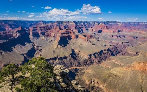
Grand Canyon South Rim Closest commercial

Flagstaff → Grand Canyon South Rim

Drive · US-180 & AZ-64
Drive time
~1h 32m
Distance
81 mi
Mode
Rental car
  • Shortest drive to the rim of any airline airport
  • Through Kaibab National Forest pine country
  • Rental cars on-site at the terminal
81 mi
~1h 32m drive
Rim airport →
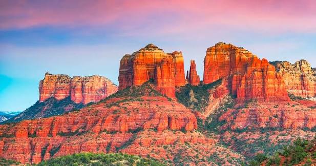
Sedona red rocks

Sedona & Williams Day Trips

Drive · red rocks & Route 66
Sedona
45 min
Williams
40 min
Mode
Rental car
  • Sedona's red-rock canyons & vortexes
  • Williams — gateway to the Grand Canyon Railway
  • Historic Route 66 between them
30–35 mi
under an hour
Sedona airport →
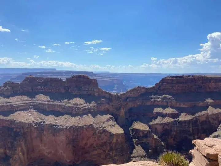
West Rim Eagle Point area

Fly the Canyon (via Las Vegas)

Connect FLG → PHX → LAS → Boulder City scenic
Then
Scenic air
Rim
West / South
Operator
GCSA
  • The way to actually fly over the canyon
  • Grand Canyon Scenic Airlines from Boulder City
  • West Rim from $259 · South Rim from $305
See routes
via Boulder City (BLD)
View hub →

* American Eagle schedules & fares are set by American Airlines and vary. Scenic flights are operated by Grand Canyon Scenic Airlines from Boulder City (BLD), near Las Vegas; West Rim from $259, South Rim from $305 (starting at, as of June 2026; fuel surcharges may apply). Confirm current schedules & fares at booking.

RouteTimeModeOperatorBest forFrom
Flagstaff → Grand Canyon South Rim
via US-180 / AZ-64
1h 32mDrive Shortest drive to the rim · 81 mi
Flagstaff → Sedona
red-rock country
45 minDrive Combine with the canyon30 mi
Phoenix / Dallas → Flagstaff (FLG)
how to get here
~50 min / ~2h 15mRegional airAmerican Eagle (CRJ700) The only scheduled serviceFares vary
Las Vegas → Boulder City scenic
connect to fly the canyon
Air + scenicMajor carriers → GCSA Flying over the canyonsee routes
§ 04

Airlines & Commercial Service

Limited but legacy — American Eagle to two hubs.

Flagstaff Pulliam is served by American Eagle, with daily regional-jet flights to Phoenix (PHX) and Dallas-Fort Worth (DFW) on CRJ700s. It's northern Arizona's busiest airport with around 70,000 passengers a year. Fares run higher than the big hubs, but you trade money for a 90-minute drive to the rim instead of four-plus hours.

CarrierDestinationsAircraftFrequencyNotes
American Eagle PHX
Phoenix
CRJ700 Daily Connects worldwide via PHX
American Eagle DFW
Dallas-Fort Worth
CRJ700 Daily One-stop to the eastern US
General aviation & charter Various GA / charter As scheduled Sports-team & private charters
Scheduled airlines PHX · DFW only No nonstop to the canyon
§ 05

Getting Here & Ground Transport

4 miles south of downtown off I-17. Rental cars on-site.

Terminal
6200 S Pulliam Dr, Flagstaff, AZ 86005 · 35.1404°N, 111.6692°W
Get directions →

To downtown Flagstaff

4 mi · ~10 min

The airport sits just south of town off I-17. Rideshare and hotel shuttles serve the terminal; downtown Flagstaff and NAU are a short hop north.

To the Grand Canyon

81 mi · 1h 32m

Drive US-180 northwest to AZ-64 for the South Rim — the shortest airport-to-rim drive in the region. Sedona and Williams are under an hour the other way.

Parking & rentals

On-site lots

Rental-car counters are at the terminal, with paid short-term, long-term and economy parking steps from the door — handy for the rim road trip.

§ 06

Airport Specs & Facilities

The credibility layer. Pilot data in the collapsible block.

Runway · asphalt
RunwayLengthWidthSurface
3/218,800 ft (2,682 m)150 ftAsphalt · HIRL/ILS
Field data
Elevation
7,014 ft (2,138 m)
Coordinates
35.1404°N, 111.6692°W
Control tower
Contract ATCT (Barton ATC)
Built
1948 · Pulliam Field
Site area
763 acres
Owner
City of Flagstaff
Note
Density altitude can exceed 10,000 ft
Approach
Phoenix Approach when ATCT closed
CTAF
Prescott Radio 122.3 / tower freq
Lighting
HIRL · MALSR Rwy 21 · PAPI both ends
Winter
Snow removal; field may close briefly
Fuel
100LL & Jet A · 24 hr
Terminal amenities
Rental cars
Terminal counters
Parking
Short / long / economy
Café
Snacks & coffee
Rideshare
& hotel shuttles
FBO / fuel
100LL & Jet A
Free Wi-Fi
In terminal
§ 07

By the Numbers

FAA & airport data, 2025.

7,014ft
Field elevation
among the highest US commercial airports
81mi
To the South Rim
~1h 32m · shortest commercial drive
~70K
Passengers a year
northern Arizona's busiest airport
2
Nonstop destinations
Phoenix & Dallas (American Eagle)
§ 09

Other Airports Nearby

Which airport should you use? Compare, then pick.

CodeAirportTo South RimServiceBest for
GCN Grand Canyon National Park
Tusayan, AZ
1 mi to park entrance Charter / scenic Arriving at the rim by air Guide →
PHX Phoenix Sky Harbor
Phoenix, AZ
231 mi / 3h 35m Commercial Cheapest fares & widest schedule Guide →
PGA Page Municipal
Page, AZ
130 mi / 2h 30m Commercial Antelope Canyon & Lake Powell Guide →
LAS Harry Reid International
Las Vegas, NV
via scenic flight Commercial Connecting to canyon scenic flights Guide →
GCW Grand Canyon West
Peach Springs, AZ
different rim · West Rim Charter / scenic Skywalk on Hualapai land Guide →
§ 10

Frequently Asked

Tap any question to expand.

Closest commercial airport to the rim — here's the rest.

Flagstaff puts the South Rim 90 minutes away by road. To fly over the canyon, connect to Grand Canyon Scenic Airlines from Boulder City near Las Vegas — flying the canyon since 1927.

Flagstaff Pulliam Airport (FLG) · 6200 S Pulliam Dr, Flagstaff, AZ 86005
Scenic reservations · (702) 638-3300 · res@flygcsa.com
Scenic flights depart Boulder City · MST year-round
Scenic.com · Brand v1 · 2026 Reservations · (702) 638-3300 · res@flygcsa.com