Grand Canyon is Open. South Rim hotels in Tusayan are open for business.

§ 01

Quick Facts

The spec snapshot. Sources: FAA / AirNav, May 2026.

Codes
BCE · KBCE
FAA LID: BCE
Elevation
7,586ft
2,313 m · among the highest
Runway
1 asphalt
3/21 · 7,395 ft
Operator
Garfield County
Utah
To Bryce Canyon NP
~7 min
4 mi · the hoodoos
Commercial
None
Charter / scenic only
Time zone
MT
UTC−7 / −6 · observes DST
Scenic flights
Daily
Helicopter · seasonal
—:—
Local time · Bryce Canyon, UT
Mountain Time — Utah observes daylight saving.
§ 02

What Bryce Canyon Gates

Tap a landmark to highlight it. Distances per Google Maps, June 2026.

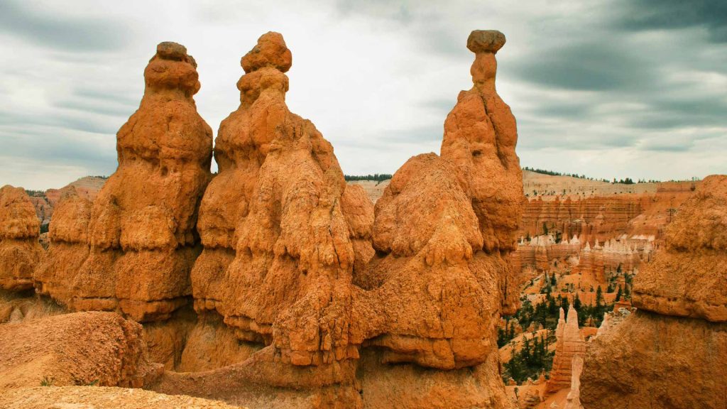
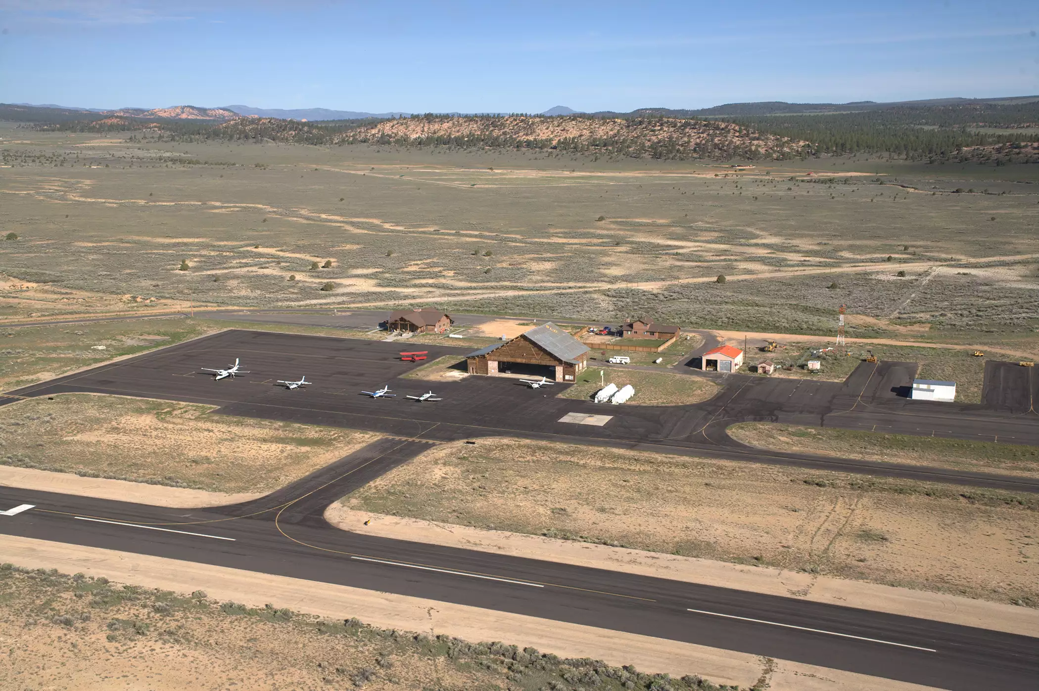
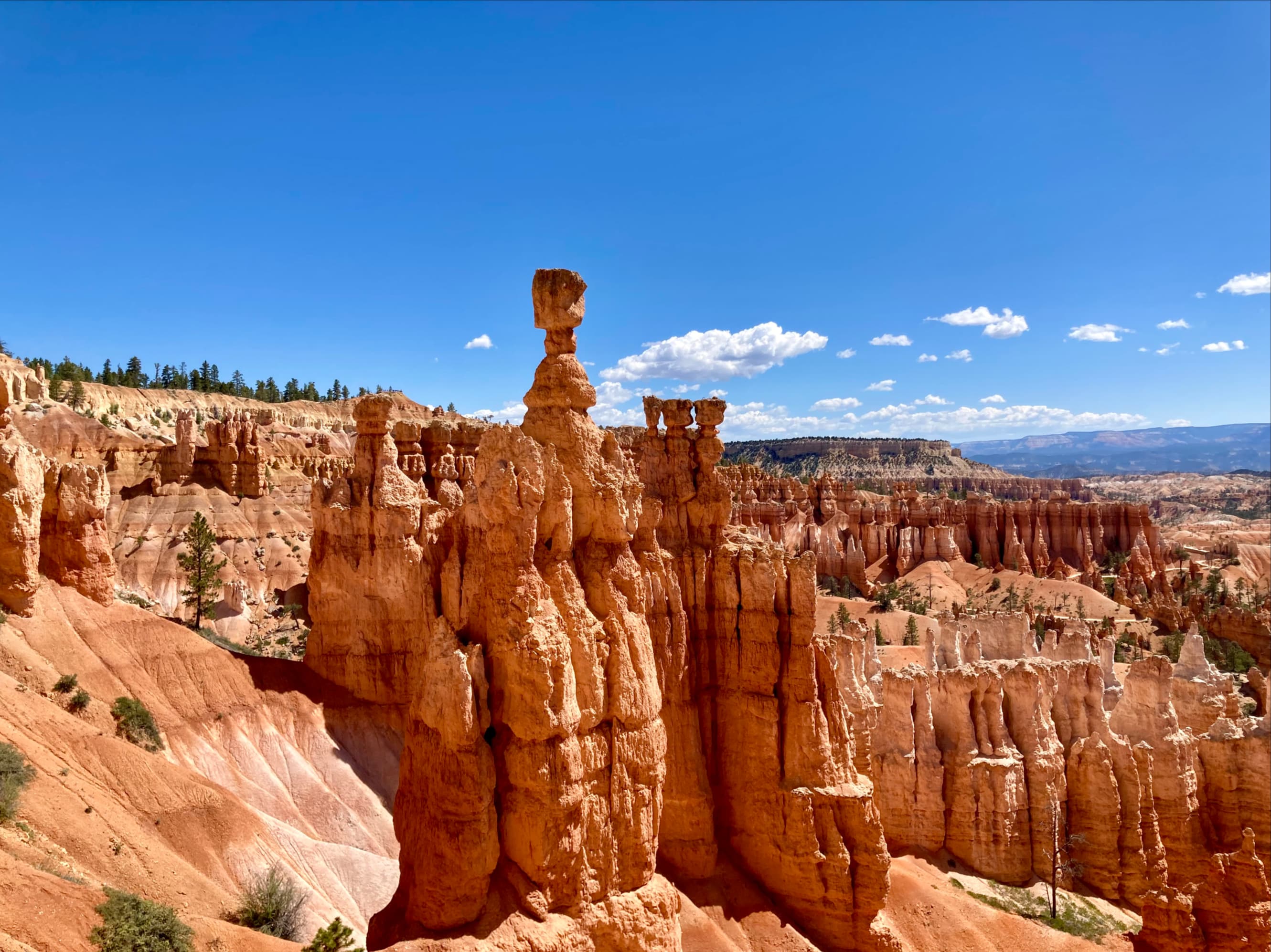
Bryce Canyon Airport is the closest airport to its namesake park — 4 miles, about 7 minutes, from Bryce Canyon National Park and its amphitheater of hoodoos, right beside Bryce Canyon City on SR-63. It's the launch point for scenic helicopter and fixed-wing tours over some of Utah's most concentrated red-rock country.

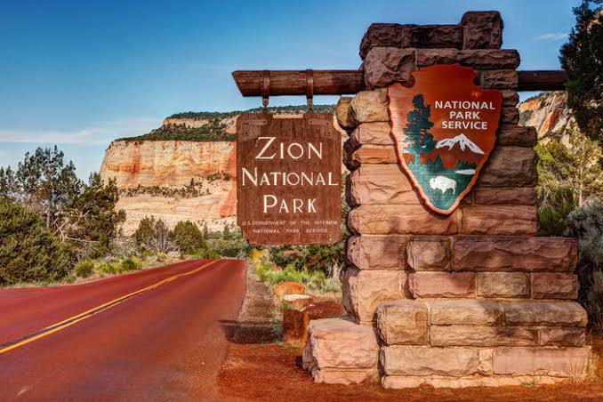
This corner of Utah is the heart of the "Grand Circle": Zion, the Grand Staircase–Escalante, Red Canyon and Lake Powell are all within reach. Because there's no scheduled airline service, most visitors fly into Cedar City, St. George, Las Vegas or Salt Lake City and drive. To fly over the Grand Canyon, route to Las Vegas and connect to our Boulder City scenic flights.

§ 03

Scenic Flights From Bryce Canyon

The signature view: tours radiating from BCE. Toggle tours vs. getting here.

Grand Circle tours ★ = Bryce Canyon (BCE)

Grand Circle air & helicopter tours

Bryce Canyon Airport is a sightseeing base. Helicopter and fixed-wing tours depart over the Bryce amphitheater, the Grand Staircase–Escalante, Zion and Lake Powell — and longer charters reach the Grand Canyon. To fly over the Grand Canyon with scheduled scenic service, connect via Las Vegas to our Boulder City flights.

Scenic air / helicopter tour
Drive · highway to Bryce
Airport / landmark
Bryce Canyon amphitheater Most popular

Bryce Amphitheater Helicopter Tour

Departs & returns Bryce Canyon (BCE)
Flight time
~15–35 min
Aircraft
Helicopter
Season
Daily, weather-dep.
  • Over the hoodoo amphitheater & rim
  • Operated by Bryce Canyon Helicopters
  • Add Red Canyon & the Grand Staircase
Seasonal
Call for current pricing
Enquire →
Grand Staircase-Escalante National Monument

Grand Staircase & Zion Air Tour

Departs & returns Bryce Canyon (BCE)
Flight time
~45–90 min
Aircraft
Heli / fixed-wing
Season
Weather-dep.
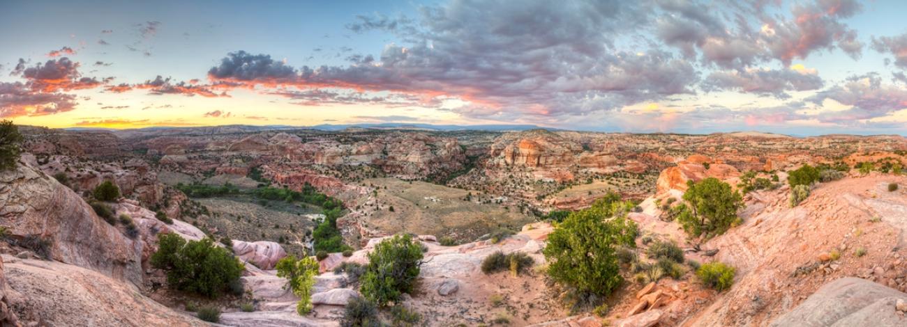
  • The Grand Staircase–Escalante terraces
  • Zion's canyons & Lake Powell
  • Extended canyon-country sightseeing
Seasonal
Call for current pricing
Enquire →
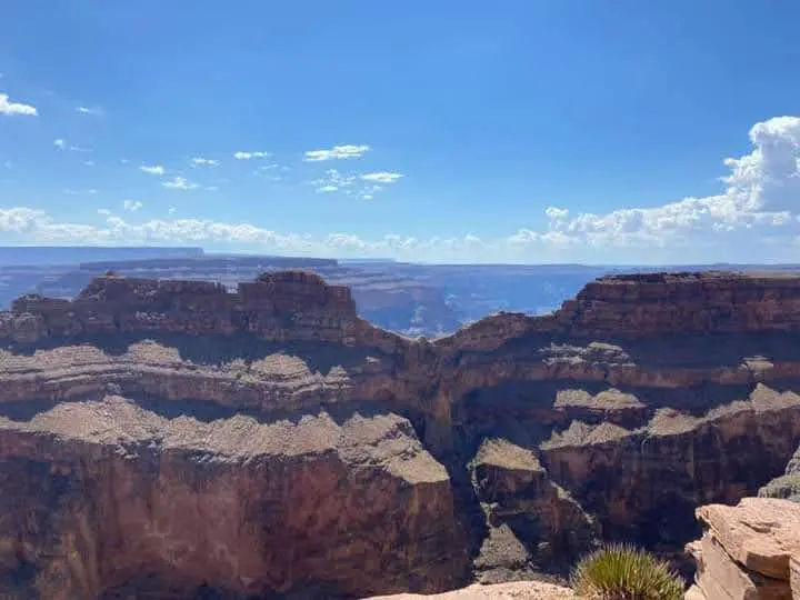
Grand Canyon West Rim Eagle Point area

Fly the Grand Canyon (via Las Vegas)

Connect via Las Vegas → Boulder City scenic flights
Then
Scenic air
Rim
West / South
Operator
GCSA
  • The way to fly over the Grand Canyon
  • Grand Canyon Scenic Airlines from Boulder City
  • West Rim from $259 · South Rim from $305
See routes
via Boulder City (BLD)
View hub →

* Bryce-area air and helicopter tours are operated by independent scenic operators based at BCE; schedules & pricing vary by season. Scenic flights over the Grand Canyon are operated by Grand Canyon Scenic Airlines from Boulder City (BLD), near Las Vegas; West Rim from $259, South Rim from $305 (starting at, as of June 2026; fuel surcharges may apply). Confirm current schedules & fares at booking.

RouteTimeModeOperatorScenic highlightsFrom
Bryce amphitheater helicopter tour
departs & returns BCE
~15–35 minHelicopterBryce Canyon Helicopters Hoodoos · rim · Red CanyonEnquire
Grand Staircase & Zion air tour
departs & returns BCE
~45–90 minHeli / fixed-wingLocal operators Escalante · Zion · Lake PowellEnquire
Bryce → Grand Canyon North Rim
by road · seasonal
~2h 30mDrive Closest Grand Canyon rim to Bryce150 mi
Las Vegas → Boulder City scenic
connect to fly the canyon
Air + scenicMajor carriers → GCSA Flying over the Grand Canyonsee routes
§ 04

Commercial Service & Operators

No scheduled airlines — a general-aviation & air-tour field.

Bryce Canyon Airport has no scheduled commercial airline service — about 94% of its traffic is general aviation, with the rest air-taxi and scenic tours. Its long 7,395-foot runway was built to accommodate larger aircraft on demand, but day to day it serves private planes, charters and the helicopter tour operators based here. For airline travel, fly into Cedar City (CDC), St. George (SGU), Las Vegas (LAS) or Salt Lake City (SLC).

UseTypeBased at BCENotes
Bryce Canyon Helicopters Helicopter tours Yes Main operator Bryce, Zion & Grand Staircase, 30+ yrs
Scenic fixed-wing tours Air-taxi sightseeing Seasonal Canyon-country flightseeing
Private & charter GA / Part 135 Yes Fuel (100LL & Jet A), pilot-controlled lighting
Scheduled airlines No Fly CDC / LAS / SLC & drive
§ 05

Getting Here & Ground Transport

Beside Bryce Canyon City on SR-63, 4 miles from the park.

Terminal
450 Airport Rd, Bryce Canyon City, UT 84764 · 37.7064°N, 112.1458°W
Get directions →

To Bryce Canyon NP

4 mi · ~7 min

The park entrance is a few minutes south on SR-63. In summer, the free Bryce Canyon Shuttle runs from Bryce Canyon City into the park's amphitheater viewpoints.

From the nearest airports

CDC 1h 25m · LAS 4h

Cedar City (CDC) is the closest commercial airport (~78 mi); St. George, Las Vegas (~4 hrs) and Salt Lake City (~4 hrs) are the common gateways. Rent a car and drive in.

Lodging & rentals

Bryce Canyon City

Ruby's Inn and other lodging sit a mile away. There's no on-airport rental counter — arrange a car at your gateway airport before driving up.

§ 06

Airport Specs & Facilities

The credibility layer. Pilot data in the collapsible block.

Runway · asphalt
RunwayLengthWidthSurface
3/217,395 ft (2,254 m)75 ftAsphalt · PCL lighting
Field data
Elevation
7,586 ft (2,313 m)
Coordinates
37.7064°N, 112.1458°W
Control tower
None — uncontrolled (CTAF)
Pattern alt
8,386 ft MSL
Site area
215 acres
Owner
Garfield County
Approach
Salt Lake City ARTCC (ZLC) · 133.6
Lighting
Pilot-controlled · 122.8 (3/5/7 clicks)
Mag variation
14°E
Fuel
100LL & Jet A · after-hrs on call
Density alt
Very high in summer (7,586 ft field)
Hours
FBO ~07:30–17:30 seasonal
Terminal amenities
Air-tour base
Heli & fixed-wing
Fuel
100LL & Jet A
Pilot lounge
Flight planning
1936 log hangar
Historic landmark
Parking
Free lot
Car rental
Not on-site
§ 07

By the Numbers

Operations data for the year ending Sep 24, 2023 (FAA).

7,586ft
Field elevation
among the highest US airports
2,189
Aircraft operations a year
≈ 6 per day
94%
Operations that are general aviation
+ 6% air taxi & scenic
1936
WPA log hangar still standing
on the National Register
§ 09

Other Airports Nearby

Which airport should you use? Compare, then pick.

CodeAirportTo BryceServiceBest for
CDC Cedar City Regional
Cedar City, UT
78 mi / 1h 25m Commercial Closest commercial airport to Bryce Compare →
LAS Harry Reid International
Las Vegas, NV
~260 mi / ~4 hrs Commercial Major gateway + canyon scenic flights Guide →
PGA Page Municipal
Page, AZ
150 mi / 2h 30m Commercial Antelope Canyon & Lake Powell Guide →
GCN Grand Canyon National Park
Tusayan, AZ
via South Rim Charter / scenic Arriving at the rim by air Guide →
BLD Boulder City Municipal
Boulder City, NV
via Las Vegas Charter / scenic Scenic-flight hub for the Grand Canyon Guide →
§ 10

Frequently Asked

Tap any question to expand.

See Bryce from the air — and the Grand Canyon too.

Bryce Canyon Airport is a scenic-flight base in Utah's canyon country. To fly over the Grand Canyon, connect via Las Vegas to Grand Canyon Scenic Airlines from Boulder City — flying the canyon since 1927.

Bryce Canyon Airport (BCE) · 450 Airport Rd, Bryce Canyon City, UT 84764
Scenic reservations · (702) 638-3300 · res@flygcsa.com
Scenic flights depart Boulder City · Mountain Time
Scenic.com · Brand v1 · 2026 Reservations · (702) 638-3300 · res@flygcsa.com