Grand Canyon is Open. South Rim hotels in Tusayan are open for business.
Sedona to Page Flights
Red rocks to Lake Powell in about an hour. This scenic point-to-point leg lifts off Sedona's mesa-top airstrip, crosses the San Francisco Peaks and the Painted Desert, and descends past Glen Canyon to Page — gateway to Navajo-guided Antelope Canyon, Horseshoe Bend, and Lake Powell — trading a 2¾-hour drive for a short flight you'll want a window seat for.
See the connectionDrive Versus Fly
The math, side by side. Sedona to Page, one way.
Drive It
- Route ~2h 45mSedona → I-17 → Flagstaff → US-89 north → Page
- Terrain Forest at Flagstaff, then open Painted Desert; few services
- Notes A long half-day on the road for a short hop by air
Fly It
- Check-in ~30 minAt the Sedona Airport terminal, atop the mesa
- SEZ → PGA ~1 hrHigh-wing Vistaliner over the San Francisco Peaks & the Painted Desert
- On arrival Land at Page (PGA), minutes from Antelope Canyon & Horseshoe Bend
The Connection, Hour by Hour
A short scheduled leg — fit it between a Sedona morning and a Page afternoon.
Outbound · SEZ → PGA
Also runs · PGA → SEZ
The Reverse Leg · Page → Sedona
The same connection runs the other way — Lake Powell, the Painted Desert, and the red rocks, from the north.
Headed the other direction? The connection also flies Page (PGA) → Sedona (SEZ) in about an hour — south off Lake Powell and back across the Painted Desert and the San Francisco Peaks to the mesa-top airstrip in the red rocks, a fraction of the 2¾-hour drive.
It's the same scenic point-to-point service, flown north-to-south. Travelers building an Arizona loop often fly one direction by air and arrive overland the other, or chain the leg with the South Rim, Monument Valley, and Boulder City connections.
Reverse leg · PGA → SEZ
Tour Packages
Fly the leg on its own, or as part of a South Rim ground tour.
What You See From The Cabin
High-wing Vistaliner — every seat next to a window. Multilingual narration.
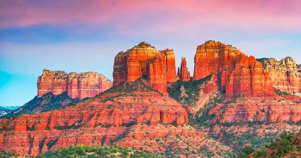
Sedona's Red Rocks
Lifting off the mesa, Cathedral Rock, Bell Rock, and the vermilion buttes of Sedona drop away beneath the wing.
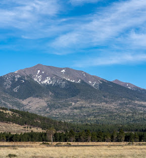
The San Francisco Peaks
Arizona's highest mountains — Humphreys Peak tops out at 12,633 ft — rise over Flagstaff, often snow-capped well into spring.
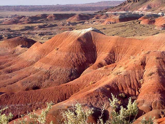
The Painted Desert
Banded badlands of red, mauve, and grey roll north across the Navajo Nation high country toward the canyon country around Page.
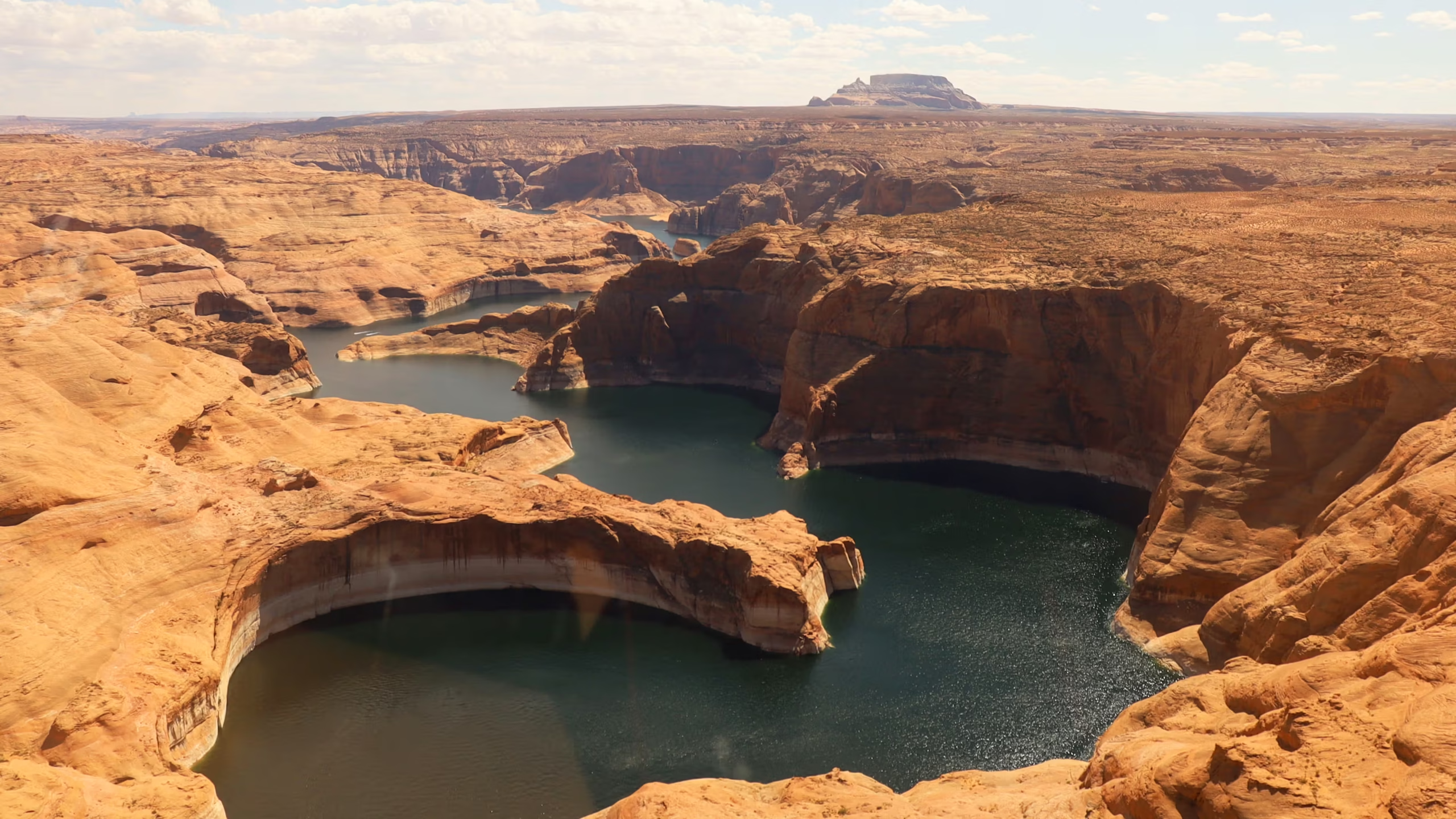
Lake Powell & Glen Canyon
Lake Powell's blue side-canyons, Glen Canyon Dam, and Horseshoe Bend come up as the Vistaliner descends into Page.
The Drive Alternative, Leg by Leg
If you're committed to the wheel — here's the route, mile by mile.
Sedona → Page (by car)
The Two Airports
Your departure & arrival, side by side.
One of the most dramatic airstrips in the Southwest — a single runway perched on a mesa about 500 feet above town, ringed by red rock, so distinctive that pilots nickname it the “USS Sedona.” It's 1.7 nm southwest of downtown; Airport Mesa is itself a noted vortex site. Non-towered general-aviation field — the leg departs by prior arrangement.
Royce K. Knight Field, atop Manson Mesa on the edge of Page — about 10 minutes from both Antelope Canyon and Horseshoe Bend, and a short drive to Lake Powell and Glen Canyon Dam. One of Scenic's terminals; Part 135 scenic and charter operators.
What's At Page When You Land
Land atop Manson Mesa — minutes from Antelope Canyon, Horseshoe Bend, and Lake Powell.
Antelope Canyon is on Navajo Nation land and can only be visited on a Navajo-guided tour — it is never entered unaccompanied, and it is the Navajo people's canyon, not "Arizona's." Tour fees and a Navajo Nation permit are collected by the authorized guides. Follow your guide's photography and footing instructions; flash-flood safety closures can happen with little notice.
What Sets Grand Canyon Scenic Airlines Apart
Heritage, fleet, and the credentials behind the flight.
Frequently Asked
Tap any question to expand.
Make it a two-icon day
A short scenic leg connecting Sedona's red rocks and Page / Antelope Canyon, on Vistaliner and Cessna Caravan aircraft. Reservations daily 6 AM – 10 PM Pacific.