Grand Canyon is Open. South Rim hotels in Tusayan are open for business.
Sedona to Grand Canyon South Rim Flights
Two of Arizona's icons in about 45 minutes. This scenic point-to-point leg lifts off Sedona's mesa-top airstrip, climbs over Oak Creek Canyon and the San Francisco Peaks, and crosses the Kaibab forest to land at the Grand Canyon's South Rim — turning a 2½-hour mountain drive into a short flight you'll want a window seat for.
See the connectionDrive Versus Fly
The math, side by side. Sedona to the South Rim, one way.
Drive It
- Route ~2h 30mSedona → SR-89A → Flagstaff → US-180 → AZ-64 → South Rim
- Terrain Oak Creek Canyon switchbacks, then ponderosa forest at 7,000 ft
- Notes A pretty drive, but a half-day round trip eats into both parks
Fly It
- Check-in ~30 minAt the Sedona Airport terminal, atop the mesa
- SEZ → GCN ~45 minHigh-wing Vistaliner over Oak Creek & the San Francisco Peaks
- On arrival Land at the South Rim Terminal, 1 mile from the National Park gate
The Connection, Hour by Hour
A short scheduled leg — fit it between a Sedona morning and a Grand Canyon afternoon.
Outbound · SEZ → GCN
Also runs · GCN → SEZ
The Reverse Leg · South Rim → Sedona
The same connection runs the other way — the Kaibab, the Peaks, and the red rocks, from the north.
Headed the other direction? The connection also flies Grand Canyon South Rim → Sedona (SEZ) in about 45 minutes — south over the Kaibab forest and the San Francisco Peaks, then down through Oak Creek country to the mesa-top airstrip in the red rocks, a fraction of the 2½-hour drive.
It's the same scenic point-to-point service, flown north-to-south. Travelers building an Arizona loop often fly one direction by air and arrive overland the other, or chain the leg with the Page, Monument Valley, and Boulder City connections.
Reverse leg · GCN → SEZ
Tour Packages
Fly the leg on its own, or as part of a South Rim ground tour.
What You See From The Cabin
High-wing Vistaliner — every seat next to a window. Multilingual narration.
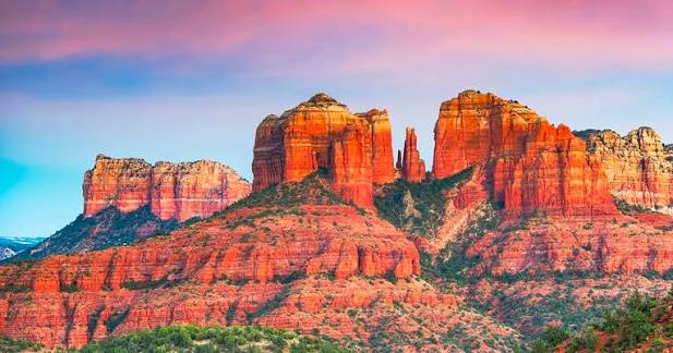
Sedona's Red Rocks
Lifting off the mesa, Cathedral Rock, Bell Rock, and the vermilion buttes of Sedona drop away beneath the wing.
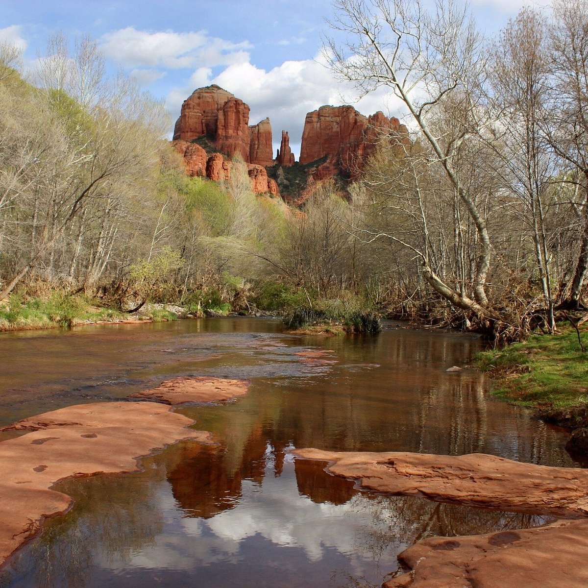
Oak Creek Canyon
The tree-lined gorge of Oak Creek climbs from the red rocks toward the rim of the Mogollon plateau — a green ribbon in the high desert.
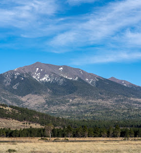
The San Francisco Peaks
Arizona's highest mountains — Humphreys Peak tops out at 12,633 ft — rise over Flagstaff, often snow-capped well into spring.
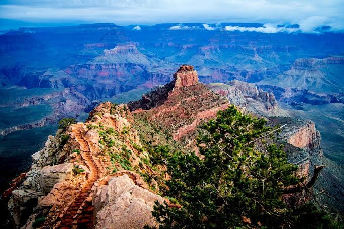
The Kaibab & the Rim
Ponderosa forest of the Kaibab Plateau gives way to the South Rim and the great chasm of the Grand Canyon on the descent into GCN.
The Drive Alternative, Leg by Leg
If you're committed to the wheel — here's the route, mile by mile.
Sedona → Grand Canyon South Rim (by car)
The Two Airports
Your departure & arrival, side by side.
One of the most dramatic airstrips in the Southwest — a single runway perched on a mesa about 500 feet above town, ringed by red rock, so distinctive that pilots nickname it the “USS Sedona.” It's 1.7 nm southwest of downtown; Airport Mesa is itself a noted vortex site. Non-towered general-aviation field — the leg departs by prior arrangement.
The closest airport to the South Rim — 1 mile from the National Park's south entrance and about 8 miles from Grand Canyon Village and the main viewpoints. State-of-Arizona owned; the South Rim Terminal is one of Scenic's four bases, so you step off the flight right at the park.
What's At The South Rim When You Land
Step off the flight one mile from the park gate — the classic viewpoints are minutes away.
The South Rim is within Grand Canyon National Park, administered by the National Park Service. A park entrance fee applies (currently $35 per vehicle, valid 7 days; the America the Beautiful pass is accepted) and is collected at the gate unless your tour includes it. The rim is unfenced in many places — stay on marked trails and behind railings, and pack out what you bring in.
What Sets Grand Canyon Scenic Airlines Apart
Heritage, fleet, and the credentials behind the flight.
Frequently Asked
Tap any question to expand.
Make it a two-icon day
A short scenic leg connecting Sedona's red rocks and the Grand Canyon South Rim, on Vistaliner and Cessna Caravan aircraft. Reservations daily 6 AM – 10 PM Pacific.